Texas is the second-largest U.S. state by both area and population. Texas map showcases diverse landscapes and geographic wonders. From deserts to coastlines, Texas offers incredible natural variety. Understanding the Texas map helps residents, travelers, and geography enthusiasts explore its rich features. The state’s unique layout also influences its culture, economy, and climate. This guide explains key details about Texas geography, regions, and notable landmarks.
Quick Facts About the Texas Map
- Texas area: 268,596 square miles.
- Borders: New Mexico, Oklahoma, Arkansas, Louisiana, Mexico, Gulf of Mexico.
- Longest river: Rio Grande.
- Highest point: Guadalupe Peak (8,751 feet).
- Major cities: Houston, San Antonio, Dallas, Austin, Fort Worth.
- Geographic regions: Gulf Coastal Plains, Interior Lowlands, Great Plains, Basin and Range Province.
The Size and Boundaries of Texas
Texas spans over 268,000 square miles, making it larger than many countries. It shares borders with New Mexico, Oklahoma, Arkansas, and Louisiana. To the south, it meets Mexico, creating a blend of cultures. Its Gulf of Mexico coastline stretches over 350 miles. This coastline impacts trade, tourism, and fishing industries. Texas also lies in two time zones, Central and Mountain, due to its vast size.
Mapping Texas shows a state rich in both land and water resources. The Rio Grande forms most of the border with Mexico. In contrast, the Red River marks its northern boundary with Oklahoma. Such geographic borders have historical and political significance.
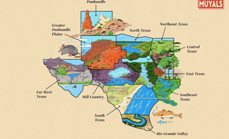
Major Geographic Regions in Texas
Texas is divided into four main geographic regions. These are the Gulf Coastal Plains, Interior Lowlands, Great Plains, and Basin and Range Province.
Gulf Coastal Plains
This region covers the eastern part of Texas. It is humid, with fertile soil and dense forests. Cities like Houston and Corpus Christi lie here, supported by oil, gas, and shipping industries.
Interior Lowlands
The north-central part of Texas belongs to the Interior Lowlands. It has rolling hills, rivers, and agricultural land. This area is known for cattle ranching and wheat production.
Great Plains
The Great Plains dominate central and northern Texas. They feature flat land, grasslands, and major wind farms. Amarillo and Lubbock are key cities here.
Basin and Range Province
Located in far west Texas, this region includes desert landscapes and mountain ranges. Big Bend National Park showcases its rugged beauty.
Waterways and Natural Features
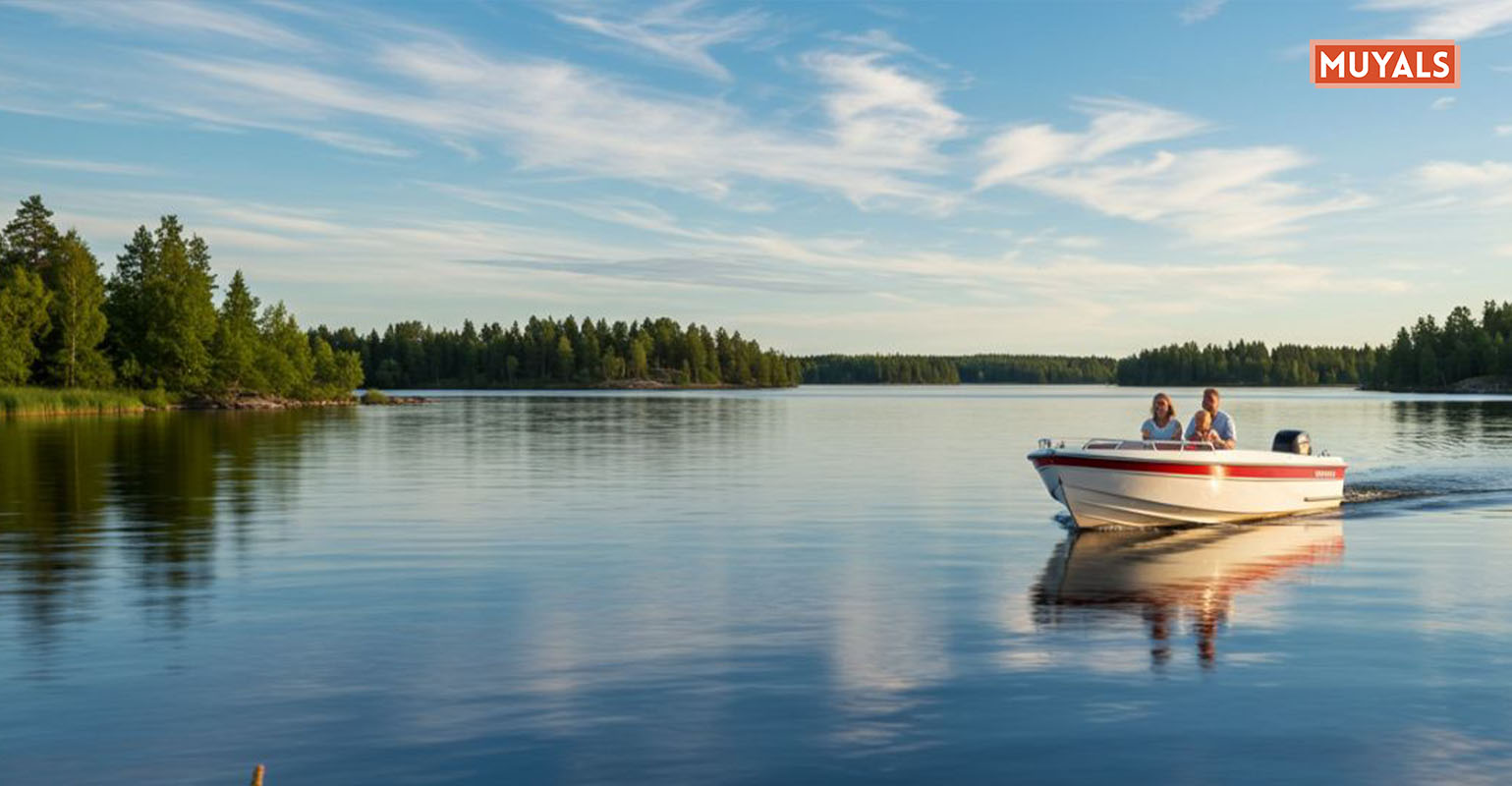
Texas maps display a rich network of rivers and lakes. The Rio Grande, Red River, and Colorado River are among the most important. These rivers provide water for agriculture and urban areas.
The state also has large lakes like Lake Texoma and Toledo Bend Reservoir. These lakes support fishing, boating, and tourism. In the east, Piney Woods offer lush forests, while the west features arid deserts.
Texas also has unique geographic formations like Palo Duro Canyon. Known as the “Grand Canyon of Texas,” it is the second-largest canyon in the United States. The state’s diverse topography offers countless opportunities for exploration.
Cultural and Economic Impact of Texas Geography
Texas geography shapes its economy in profound ways. Coastal areas thrive on shipping, fishing, and oil refining. The central plains support farming and ranching, feeding both the state and nation. West Texas is rich in oil and natural gas reserves.
Culturally, geography has created diverse lifestyles. East Texas leans toward Southern traditions, while West Texas embraces frontier spirit. Along the border with Mexico, Hispanic heritage strongly influences daily life. The Texas map reflects this blend of cultures and industries.
Conclusion
The Texas map reveals much more than lines and boundaries. It tells the story of a state’s history, culture, and economy. From mountain peaks to sandy beaches, Texas offers incredible variety. Understanding its geographic features enriches travel experiences and deepens appreciation for its diversity. Whether you are a resident or visitor, exploring the Texas map is a journey worth taking.
FAQs
1. What are the four main regions of Texas?
The Gulf Coastal Plains, Interior Lowlands, Great Plains, and Basin and Range Province.
2. Which river forms the border between Texas and Mexico?
The Rio Grande.
3. What is the highest point in Texas?
Guadalupe Peak at 8,751 feet.
4. How long is the Texas coastline?
About 350 miles along the Gulf of Mexico.
5. Which Texas city is located in the desert region?
El Paso, in the Basin and Range Province.
Visit our website: Muyals